 Grießner Hochbrett
Starting point: Regio Tech Hochfilzen
Destination point: Grießner Hochbrett
Easy
Elevation uphill:
1500 m
1500 m
Highest point:
2470 m
2470 m
Distance:
7,7 km
7,7 km
Time:
10:00 h
10:00 h
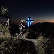 KAT 100 Endurance Trail
Starting point: village centre Fieberbrunn
Destination point: Kitzbühel
Easy
Elevation uphill:
4860 m
4860 m
Highest point:
2175 m
2175 m
Distance:
81,4 km
81,4 km
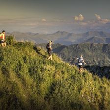
 Großer Rettenstein
Starting point: Hintenbachalm
Destination point: Hintenbachalm
EasyThe proud one in the Spertental 2366m
Elevation uphill:
1338 m
1338 m
Highest point:
2366 m
2366 m
Distance:
14,4 km
14,4 km
Time:
6:30 h
6:30 h
 Lärchegg
Starting point: Kirchdorf in Tirol – Fischbachalm or Griesner Alm parking lot
Destination point: Kirchdorf in Tirol – Fischbachalm or Griesner Alm parking lot
EasyA Summit and a Unique Landscape amid the Kaiser Mountains.
Elevation uphill:
1314 m
1314 m
Highest point:
1982 m
1982 m
Distance:
9,3 km
9,3 km
Time:
8:30 h
8:30 h
 05 Andreas Widhölzl Runde
Starting point: Tourist office PillerseeTal, Dorfplatz 1, 6391 Fieberbrunn
Destination point: Tourist office PillerseeTal, Dorfplatz 1, 6391 Fieberbrunn
EasyOn the training tracks of ski jumping world champion and Olympic champion Andreas Widhölzl. A scenically beautiful, quite challenging running route!
Elevation uphill:
510 m
510 m
Highest point:
1240 m
1240 m
Distance:
12,0 km
12,0 km
 KAT100 Miles
Starting point: village centre Fieberbrunn
Destination point: village centre Fieberbrunn
Easy
Elevation uphill:
9929 m
9929 m
Highest point:
2175 m
2175 m
Distance:
173,2 km
173,2 km
 Ellmauer Tor
Starting point: Kirchdorf in Tirol - Kaiserbachtal
Destination point: Ellmau am Wilden Kaiser – Wochenbrunner Alm
EasyHike with superb views from Wilder Kaiser
Elevation uphill:
949 m
949 m
Highest point:
1981 m
1981 m
Distance:
7,8 km
7,8 km
Time:
6:00 h
6:00 h
 Mitterhorn 2.504m Loferer Steinberge
Starting point: Waidring, Aschertal
Destination point: Gipfel Mitterhorn 2.504
EasyZustieg über Aschertal aufgrund von Holzarbeiten bis 5.10. nicht möglich.
Elevation uphill:
1730 m
1730 m
Highest point:
2506 m
2506 m
Distance:
6,7 km
6,7 km
Time:
9:00 h
9:00 h
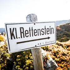 Kleiner Rettenstein
Starting point: Aschau
Destination point: Aschau
EasyThe wild one in Spertental 2217m
Elevation uphill:
1359 m
1359 m
Highest point:
2216 m
2216 m
Distance:
19,0 km
19,0 km
Time:
6:30 h
6:30 h
 Kleines Törl
Starting point: Going am Wilden Kaiser - Prama
Destination point: Kirchdorf in Tirol - Kaiserbachtal
EasyA Quiet Corner in the Wilder Kaiser
Elevation uphill:
1274 m
1274 m
Highest point:
2100 m
2100 m
Distance:
11,2 km
11,2 km
Time:
8:00 h
8:00 h