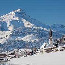
 Winter hiking trail Grilling-Obwiesen
EasyA romantic hike with a view of Kirchberg.
120 m
945 m
5,8 km
1:45 h
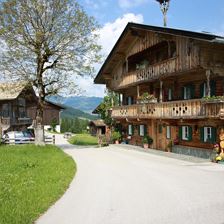 The Daxlhöfe
EasyIn the middle of traditional farms!
150 m
892 m
7,5 km
2:15 h
 Hundsbichl Snowshoeing Tour
EasyEasy snowshoeing tour through a romantic winter landscape
32 m
765 m
1,6 km
0:30 h
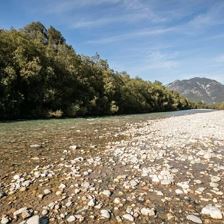 Way of Saint James in Tirol: Lofer - St. Johann in Tirol
EasyPeace and contemplation - green Saalach valley - refreshing Großache river
224 m
787 m
27,2 km
7:30 h
 Way of the Cross Waidring
EasyThe Way of the Cross symbolises the suffering and death of Jesus Christ in 14 stations that invite you to reflect. The Schäferau Chapel was built about 300 years ago and is now a sacred treasure.
40 m
820 m
1,0 km
0:30 h
 Winter hike St. Jakob i.H. -Filzen-Obwall-Fieberbrunn
EasyOn the sunny side you walk above St. Jakob to Fieberbrunn - Rosenegg and are accompanied by the magnificent panorama. Buchensteinwand with Jakobskreuz, Kitzbüheler Horn, Wildseeloder, Spielberg and Wi...
65 m
900 m
5,0 km
1:30 h
 Oberndorf: Old Roman Way to Kitzbühel
EasySmall chapels and typical tyrolian farms characterize this valley hike to the neighboring town of Kitzbühel.
111 m
801 m
7,2 km
2:00 h
 Wintercable-Car Hiking: Brixen - Choralpe - Oberwindau
EasyA “ facilitated” circular walk with heavenly views!
1800 m
6,0 km
2:15 h
 Rosenweg
Easy
17 m
712 m
1,9 km
0:30 h
 Mödlingweg
EasyLeisurely hike with a view of the centre of Hopfgarten.
84 m
701 m
2,3 km
0:50 h