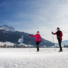
 Rettenbach Trail
Starting point: St. Johann in Tirol - Koasa Stadion
Destination point: St. Johann in Tirol - Koasa Stadion
EasyKlasse Loipe für Anfänger mit mehr Anspruch.
Elevation uphill:
146 m
146 m
Highest point:
690 m
690 m
Distance:
5,9 km
5,9 km
 Streubödentour 260
Starting point: bottom station cable car Streuböden
Destination point: middle station cable car Streuböden
EasySummer 2024 Closed due to the new construction of the Streubödenbahn! Uphill route with connection to the Lärchfilzhochalmrunde 256
Elevation uphill:
400 m
400 m
Highest point:
1230 m
1230 m
Distance:
4,0 km
4,0 km
Time:
1:00 h
1:00 h
 Wintercable-Car Hiking: Brixen - Choralpe - Oberwindau
Starting point: Zentrum von Westendorf
Destination point: Zentrum von Westendorf
EasyA “ facilitated” circular walk with heavenly views!
Highest point:
1800 m
1800 m
Distance:
6,0 km
6,0 km
Time:
2:15 h
2:15 h
 Toboggan run Hoametzl Hochfilzen
Starting point: Hoametzlhütte Hochfilzen
Destination point: Parkplatz Skilift Hochfilzen
Easy1.5 km long natural toboggan run, which is illuminated until midnight. Toboggan rental at the start of the track.
Distance:
1,5 km
1,5 km
 Adventure hike Kleine Salve
Starting point: Mountain station Kleine Salve
Destination point: Mountain station Kleine Salve
EasyA tour around the Salvenwald forest
Elevation uphill:
420 m
420 m
Highest point:
1565 m
1565 m
Distance:
7,1 km
7,1 km
Time:
2:30 h
2:30 h
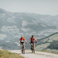 Gruberberground (MTB route 274)
Starting point: Infobüro Hopfgarten, 622m
Destination point: Gruberberg, 888m
Easy
Elevation uphill:
300 m
300 m
Highest point:
890 m
890 m
Distance:
4,8 km
4,8 km
Time:
1:00 h
1:00 h
 Gasthof Nieding
Starting point: Parkplatz Gondelbahn Hochbrixen
Destination point: Gasthof Nieding
EasyCosiness and a wonderful view!
Elevation uphill:
350 m
350 m
Highest point:
1150 m
1150 m
Distance:
3,4 km
3,4 km
Time:
1:15 h
1:15 h
 Hängebank Rastplatz Lehrpfad
Starting point: Parkplatz Kasplatzl
Destination point: Parkplatz Kasplatzl
Easy
Elevation uphill:
330 m
330 m
Highest point:
1460 m
1460 m
Distance:
7,8 km
7,8 km
Time:
2:50 h
2:50 h