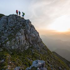
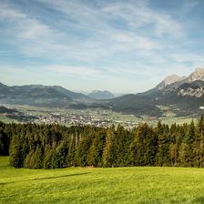
 Hintere Goinger Halt
Starting point: Going - Wochenbrunner Alm
Destination point: Kirchdorf - Griesenau
EasyDemanding Tour on the Infamous Kaiser Mountains.
Elevation uphill:
1124 m
1124 m
Highest point:
2173 m
2173 m
Distance:
8,9 km
8,9 km
Time:
7:30 h
7:30 h
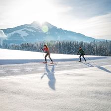 Buchberg Trail
EasyLanglaufen und Idylle genießen.
Elevation uphill:
93 m
93 m
Highest point:
730 m
730 m
Distance:
7,5 km
7,5 km
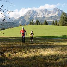 Hotel Kitzbühler Horn Runde
Starting point: Oberndorf - Bichlachbad
Destination point: Oberndorf - Bichlachbad
EasyKonditionsaufbau in atemberaubender Bergkulisse.
Elevation uphill:
415 m
415 m
Distance:
10,7 km
10,7 km
 Project & Bautechnik Runde
Starting point: St. Johann in Tirol - Koasastadion
Destination point: St. Johann in Tirol - Koasastadion
EasyLeisurely run along the Ache - the Project & Bautechnik circuit.
Elevation uphill:
15 m
15 m
Distance:
9,2 km
9,2 km
 Leukentalradweg
Starting point: Kössen
Destination point: Jochberg
EasyLeukental cycle path from Kössen to Jochberg
Elevation uphill:
189 m
189 m
Highest point:
1068 m
1068 m
Distance:
48,0 km
48,0 km
Time:
4:20 h
4:20 h
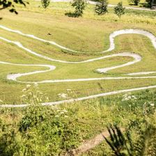 Skill Park
EasyExploring the mountain roads on two wheels is a special experience and is so much fun!
Distance:
0,0 km
0,0 km
 Flusserlebnis Großache mit Flugplatzrunde
Starting point: St. Johann in Tirol - Main square
Destination point: St. Johann in Tirol - Main square
EasyThis tour is perfect for a quick bike ride with rural as well as sophisticated cultural highlights.
Elevation uphill:
50 m
50 m
Highest point:
688 m
688 m
Distance:
21,7 km
21,7 km
 Einsiedelei – Hinterkaiser – Steinerberg
Starting point: St. Johann in Tirol tourist office
Destination point: St. Johann in Tirol tourist office
EasyTown to Country
Elevation uphill:
184 m
184 m
Highest point:
791 m
791 m
Distance:
9,8 km
9,8 km
Time:
3:00 h
3:00 h
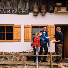 Stubenalm
Starting point: Kirchdorf Altmühl
Destination point: Kirchdorf Altmühl
EasyBlooming Alpine Pastures and Superb Views of the Kaiser’s Precipitous Rock Walls.
Elevation uphill:
288 m
288 m
Highest point:
1062 m
1062 m
Distance:
5,1 km
5,1 km
Time:
2:10 h
2:10 h
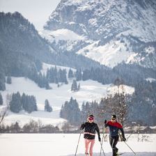 Gasteig Altitude Trail
EasySnow-sure cross-country trail for experienced skiers.
Elevation uphill:
67 m
67 m
Highest point:
830 m
830 m
Distance:
3,1 km
3,1 km