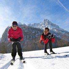
 Dorfrunde Trail
Starting point: Oberndorf in Tirol - Zentrum
Destination point: Oberndorf in Tirol - Zentrum
Easy
Highest point:
687 m
Distance:
1,2 km
Time:
0:18 h
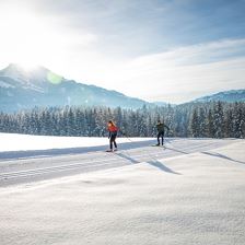
 Family Trail
Starting point: Oberndorf in Tirol - Zentrum
Destination point: Oberndorf in Tirol - Zentrum
EasyCross-country fun for young and old.
Elevation uphill:
60 m
Highest point:
670 m
Distance:
7,5 km
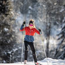
 Griesenau Trail
Starting point: Kirchdorf in Tirol - Kramerhof
Destination point: Kirchdorf in Tirol - Kramerhof
EasyEasy cross-country skiing enjoyment in the Wilder Kaiser nature reserve.
Elevation uphill:
50 m
Distance:
5,6 km
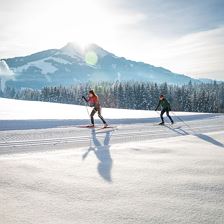
 Bichlach Trail
Starting point: Oberndorf -Zentrum
Destination point: Oberndorf -Zentrum
EasyA nature experience with a view of the Kaiser for advanced and good runners.
Elevation uphill:
181 m
Highest point:
760 m
Distance:
12,5 km
 Hinterkaiser-Höflinger Trail
Starting point: St. Johann in Tirol - Koasastadion
Destination point: St. Johann in Tirol - Koasastadion
EasyChallenging cross-country ski trail at the foot of the Kaiser Mountains.
Elevation uphill:
228 m
Highest point:
782 m
Distance:
15,0 km
 Rummler Trail
Starting point: Koasastadion St. Johann in Tirol
Destination point: Koasastadion St. Johann in Tirol
Easy
Elevation uphill:
123 m
Highest point:
770 m
Distance:
7,9 km
 Buchberg Trail
Starting point: Oberndorf in Tirol - Zentrum
Destination point: Oberndorf in Tirol - Zentrum
EasyLanglaufen und Idylle genießen.
Elevation uphill:
93 m
Highest point:
730 m
Distance:
7,5 km
 Sonnen Trail
Starting point: St. Johann in Tirol - Sportflugplatz
Destination point: St. Johann in Tirol - Sportflugplatz
EasyEasy to moderately difficult terrain for experienced people on the sunny side.
Elevation uphill:
175 m
Highest point:
700 m
Distance:
13,0 km
 Gasteig Altitude Trail
Starting point: Kirchdorf in Tirol - Hotel Gut Kramerhof
Destination point: Kirchdorf in Tirol - Hotel Gut Kramerhof
EasySnow-sure cross-country trail for experienced skiers.
Elevation uphill:
67 m
Highest point:
830 m
Distance:
3,1 km
 Weitau Trail
Starting point: St. Johann in Tirol - Koasa Stadion
Destination point: St. Johann in Tirol - Koasa Stadion
EasyFor beginners with a wide view over the valley.
Elevation uphill:
74 m
Highest point:
670 m
Distance:
3,5 km
 Reitham Trail
Starting point: St. Johann in Tirol - Sportflugplatz
Destination point: St. Johann in Tirol - Sportflugplatz
EasyEasy cross-country skiing enjoyment for beginners.
Elevation uphill:
89 m
Highest point:
700 m
Distance:
7,0 km
 Training Trail
EasyFür Spezialisten mit hohem Anspruch.
Elevation uphill:
50 m
Highest point:
750 m
Distance:
2,0 km
 Rettenbach Trail
Starting point: St. Johann in Tirol - Koasa Stadion
Destination point: St. Johann in Tirol - Koasa Stadion
EasyKlasse Loipe für Anfänger mit mehr Anspruch.
Elevation uphill:
146 m
Highest point:
690 m
Distance:
5,9 km
 Erpfendorf Trail
Starting point: Erpfendorf - Church
Destination point: Erpfendorf - Steinbacher
EasyAll around Erpfendorf with only slight climbs.
Elevation uphill:
43 m
Highest point:
682 m
Distance:
4,5 km
 Lärchenhof Trail
Starting point: Lärchenhof
Destination point: Lärchenhof
EasyTraining circuit at the Lärchenhof.
Elevation uphill:
11 m
Highest point:
698 m
Distance:
1,7 km
 Kirchdorf Sonnen Trail
Starting point: Kirchdorf in Tirol - Parking beside Metzgerhaus
Destination point: Kirchdorf in Tirol - Parking beside Metzgerhaus
EasySunny valley trail for beginners.
Highest point:
650 m
Distance:
9,5 km
 St. Johanner Panorama Trail
Starting point: Koasastadion St. Johann in Tirol
Destination point: Koasastadion St. Johann in Tirol
Easy
Elevation uphill:
50 m
Highest point:
700 m
Distance:
3,0 km
 Training Nighttrail
Starting point: St. Johann in Tirol - Koasa Stadion
Destination point: St. Johann in Tirol - Koasa Stadion
EasyA 'night' experience for everybody.
Elevation uphill:
16 m
Highest point:
670 m
Distance:
2,5 km
 Kramerhof Trail
Starting point: Kirchdorf in Tirol - Kramerhof
Destination point: Kirchdorf in Tirol - Kramerhof
Easy
 Training Trail Reitham
Starting point: St. Johann in Tirol - Sportflugplatz
Destination point: St. Johann in Tirol - Sportflugplatz
Easyside.
Elevation uphill:
40 m
Highest point:
741 m
Distance:
1,2 km