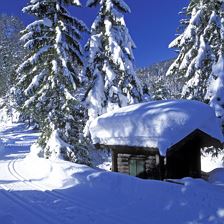
 Hängebank Rastplatz Lehrpfad
Ausgangspunkt Kasplatzl
Endpunkt Kasplatzl
Leicht
Höhenmeter:
340 m
340 m
Höchster Punkt:
1460 m
1460 m
Streckenlänge:
7,8 km
7,8 km
Zeit:
2:50 h
2:50 h
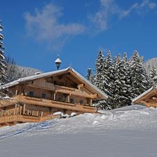
 Brixen im Thale und Westendorf
Ausgangspunkt Kalswirt
Endpunkt Brixen im Thale
LeichtA pleasant hiking tour through the valley from Kirchberg to Brixen im Thale or Westendorf.
Streckenlänge:
8,4 km
8,4 km
Zeit:
2:00 h
2:00 h
 Winter Hike to Gasthaus Ruetzen
Ausgangspunkt Kalswirt
Endpunkt Ruetzen
LeichtBeautiful Winter hike to an idyllic mountain inn on the Sonnberg.
Höhenmeter:
250 m
250 m
Höchster Punkt:
1058 m
1058 m
Streckenlänge:
3,9 km
3,9 km
Zeit:
2:30 h
2:30 h
 Bike&Hike Guggenkögele
Ausgangspunkt Infobüro Westendorf
Endpunkt Guggenkögele 1.866m
LeichtDas Guggenkögele, der Gipfel des Nachtsöllbergs, bietet trotz seinen nur "1.866m" einen umwerfenden Ausblick aufs Brixental, Wilden Kaiser, Hohen Tauern unvm...
Höhenmeter:
1060 m
1060 m
Streckenlänge:
26,0 km
26,0 km
Zeit:
4:00 h
4:00 h
 Hängebank Schneckgass
Ausgangspunkt Ortszentrum Brixen im Thale
Endpunkt Ortszentrum Brixen im Thale
Leicht
Höhenmeter:
60 m
60 m
Höchster Punkt:
860 m
860 m
Streckenlänge:
2,5 km
2,5 km
Zeit:
0:45 h
0:45 h
 Wappenweg
Ausgangspunkt Gondelbahn Brixen im Thale
Endpunkt Gondelbahn Brixen im Thale
LeichtThe Hohe Salve, one of the most beautiful panoramic mountains in Tyrol!
Höhenmeter:
1000 m
1000 m
Höchster Punkt:
1826 m
1826 m
Streckenlänge:
15,5 km
15,5 km
Zeit:
6:00 h
6:00 h
 Ehrenbachhöhe reservoir
Ausgangspunkt Fleckalmbahn
Endpunkt Ehrenbachhöhe
LeichtVia the Fleckalm to the Ehrenbachhöhe.
Höhenmeter:
973 m
973 m
Höchster Punkt:
1784 m
1784 m
Streckenlänge:
8,8 km
8,8 km
Zeit:
2:30 h
2:30 h
 Hängebank Zinsberg
Ausgangspunkt Bergstation Hochbrixen
Endpunkt Bergstation Hochbrixen
Leicht
Höhenmeter:
380 m
380 m
Höchster Punkt:
1670 m
1670 m
Streckenlänge:
9,0 km
9,0 km
Zeit:
3:15 h
3:15 h
 Brixner Gangl
Ausgangspunkt Infobüro Brixen im Thale
Endpunkt Infobüro Brixen im Thale
LeichtBeautiful round tour around Brixen!
Höhenmeter:
150 m
150 m
Höchster Punkt:
890 m
890 m
Streckenlänge:
7,1 km
7,1 km
Zeit:
2:30 h
2:30 h
 To the hamlet of Feichten – at the foot of the Hohe Salve
Ausgangspunkt Tourismusverband Westendorf
Endpunkt Tourismusverband Westendorf
LeichtThis beautiful circular route takes you through the hamlet of Feichten, where there are many heritage farmhouses to be seen.
Höhenmeter:
100 m
100 m
Höchster Punkt:
782 m
782 m
Streckenlänge:
7,3 km
7,3 km
Zeit:
2:00 h
2:00 h